
Getting Around Valencia
NOTE: The wearing of masks are no longer required when using public transportation.

City Maps and Transportation Services

Useful and Important Information
Here is your go-to-list of emergency numbers, hospitals, consuls and embassies, main shopping centres and more.

District Map
Valencia is divided into 19 administrative districts then divided into several quarters. Here is a map that shows all of it.
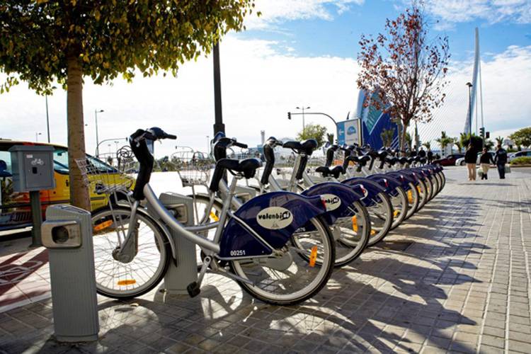
Valenbisi
Valenbisi is the bicycle sharing system in Valencia. There are over 275 Valenbisi stations making it an easy, convenient and inexpensive way to move around the city.

Map of Valencia
A detailed street map with monuments, museums, gardens, leisure centers, places of interest, sports, transport stations, parking, metro plan, streets, and more.

Metro Map
A map of Valencia’s 6 main metro lines which cover most of the city and some suburbs. Metro Map provided by Metro Valencia.

Bus to Albufera
Bus Line 25 connects Valencia to Albufera following a scenic route. This line provides transport to and from the districts south of the city centre.


Bus Routes
Over 52 bus routes and schedules for the city of Valencia. Map is provided by the Valencia Municipal Transport Company (EMT).

Summer Bus Routes
Summer bus schedule runs from July 1 to September 1.